Optimising forestry operations planning in Finland
How can forest operations be better planned and optimized? The Finnish Meteorological Institute produces maps predicting the status of the forest soil and its trafficability for heavy operation machines based on seasonal forecasts.

Background
Forests cover 75% of Finland's surface and they play a significant role in the country's economy, in particular for wood export. They also represent a critical source for fire risk during summer, if not correctly maintained. With the increasing impact of climate change, however, the frequency of having a terrain suitable for the passage of heavy harvesting machines is decreasing. This makes forestry maintenance operations very hard to plan and it increases the risk of damaging the soil ecosystem with the use of the heavy machines, especially on peatlands and clay dominated soils.
Optimized forestry operation planning
Harvester Seasons service is created for and with forestry stakeholders, to support better forest operation planning and reduce the risk of production shortfalls.
Metsäteho and its shareholders see the development of services like Harvester Seasons as crucial in optimizing resource efficiency while minimizing environmental impacts of harvesting operations
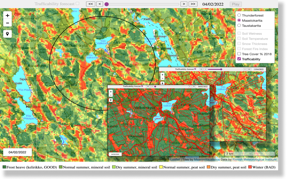
Harvester Season is created by the Finnish Meteorological Institute and offers of high-resolution maps of trafficability of forestry areas classified based on the type of terrain condition, for the European domain.
Using ensembles to offer long-term forecasts
The service works as follows:
The Seasonal weather forecasts from Copernicus Climate Change service, obtained through WEkEO, is bias-corrected with local climate statistics.
Together with meteorological weather forecasts those 51 ensembles forecasts are then applied as temperature and precipitation estimates.
These are used as input by the Hydrological Operations and Prediction System (HOPS) to predict a range of possible values for soil moisture and ground temperature for the next 6 months.
- The ensemble forecasts are evaluated with threshold values considered critical for the highly dynamic bearing capacity of relevant soil types. When at least 90% of the runs agree that one or more of these threshold will be reached or not reached, the forecast for good or bad trafficability conditions is provided, respectively
Implemented by
Key features
Real-time service and 6 months prediction
Information of trafficability is provided with 6 months in advance, for an area of 16 m radius from a selected point, and accessible via web, mobile app and API.
Availability of data for 51 ensemble forecasts
The different predictions derived from 51 model runs are accessible through the different graphs for each location on the map.
Co-designed with forestry industry stakeholders
Designed with forestry operation managers, operation planners, forest-men, harvester contractors and operators via the big forest industry groups.
Benefits of WEkEO for Harvester Seasons
Harvester Seasons is implemented using computing facilities of DIAS platform WEkEO. Among the benefits of the platform, WEkEO provides:
- Automatic input data provisioning of Copernicus EO data
- Customizable ready-to-use Virtual Machines
- Access to processing virtual environments
- Expert support, training, and uptake resources directly from the organisations that produce the data.
Contact us to know more about Harvester Seasons.


